Where
did people live?
Below
is an extract from an undated Clifford J Utting street plan of Kingston upon
Hull showing the area between Beverley Road and Dansom Lane. The streets where our ancestors lived are
highlighted in yellow. Hodgson Street
and Norfolk Street are shown in greater detail further down and there is a
photograph of New Zealand Terrace off Providence Row on the page about Thomas
Joseph Chapman’s family tree.
The map shows an area of less
than one square mile.
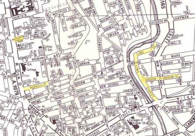
Lime Street is where John Dean (Helena Chapman’s mum’s mum’s dad) lived in the 1840’s and 1850’s. John was born in Marsden in 1811, married Elizabeth from Salford (Manchester) and had two daughters both born in Stockport (Manchester) in 1834 and 1842. By the time of the 1851 census the family were living in Hull where he worked as a fish monger. I don’t know whereabouts on Lime Street the family lived but the southern end is close to the docks and would have been more convenient for a fish monger. There are two towns called Marsden. One is on the border of West Yorkshire and Manchester making sense of the Manchester connection but not his trade (fish in the middle of the country before the advent of the railway - yuk!) The other is in Tyne and Wear near the coast making sense of his trade but not his Manchester connection.
Hodgson
Street, where
three generations of the Stephenson family were born, lies to the east of the
river Hull in an area called The Groves.
Below is an extract from Alan Godfrey’s 1928 map of east Hull showing
Hodgson Street.
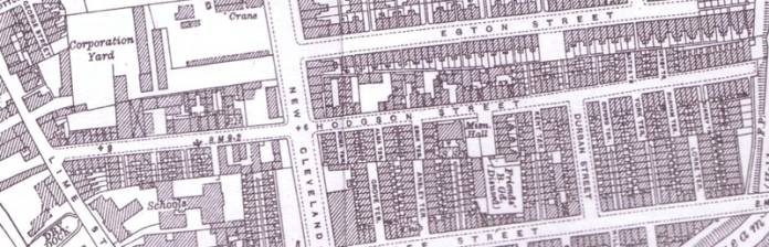
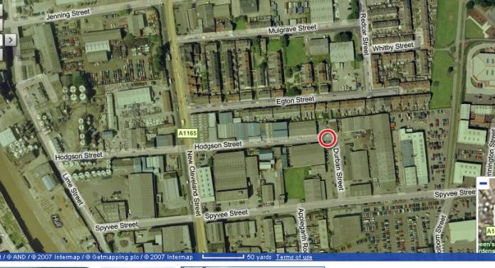
I’d like to identify the actual houses numbered 5, 24 and 51 on the map but there are a few unnamed terraces running off Hodgson Street, especially west of New Cleveland Street which is where 5 and most likely 24 where, so it’s a bit tricky. Hodgson Street is still there but the houses are gone. The screen print below is taken from multimap.co.uk and shows Hodgson Street as highly industrialised.
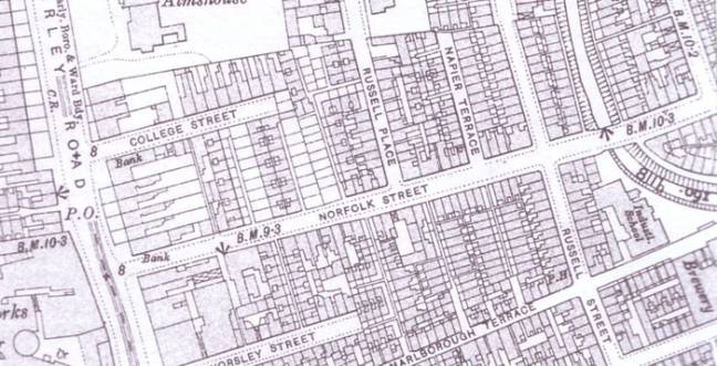
Norfolk
Street. The map below is an extract from Alan
Godfrey’s 1908 map of west Hull and shows Norfolk Street. Thomas Joseph Chapman was born at 7½ Norfolk
Street in 1857. If anyone can identify
that on the map please let me know! (I
use the basis that odd numbers are on the left and numbering starts at the end
of the road which leads onto the busiest road).
Back to Helena Chapman’s family tree